Inlet Conditions
The information on this page is provided as a planning and reference tool only. Inlet conditions, bottom structure, and reef productivity can change quickly due to weather, tides, and seasonal shifts. Always verify conditions with official charts, current observations, and safe navigation practices before heading out.
If you notice changes, updates, or have local insight to share, consider joining the community and contributing to the discussion. Local knowledge stays strongest when it’s shared responsibly.
Inlet Surveys
These surveys are provided for general reference only and are not intended for navigation. Mariners should always rely on official NOAA charts and current conditions.
Bogue Inlet
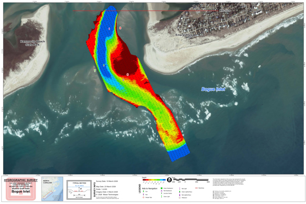
Date: 19 March, 2026
Source: U.S. Army Corps of Engineers
Public domain material. Provided for reference only. Conditions change rapidly.
Download PDF: Bogue Inlet, 19 March, 2026
New River Inlet
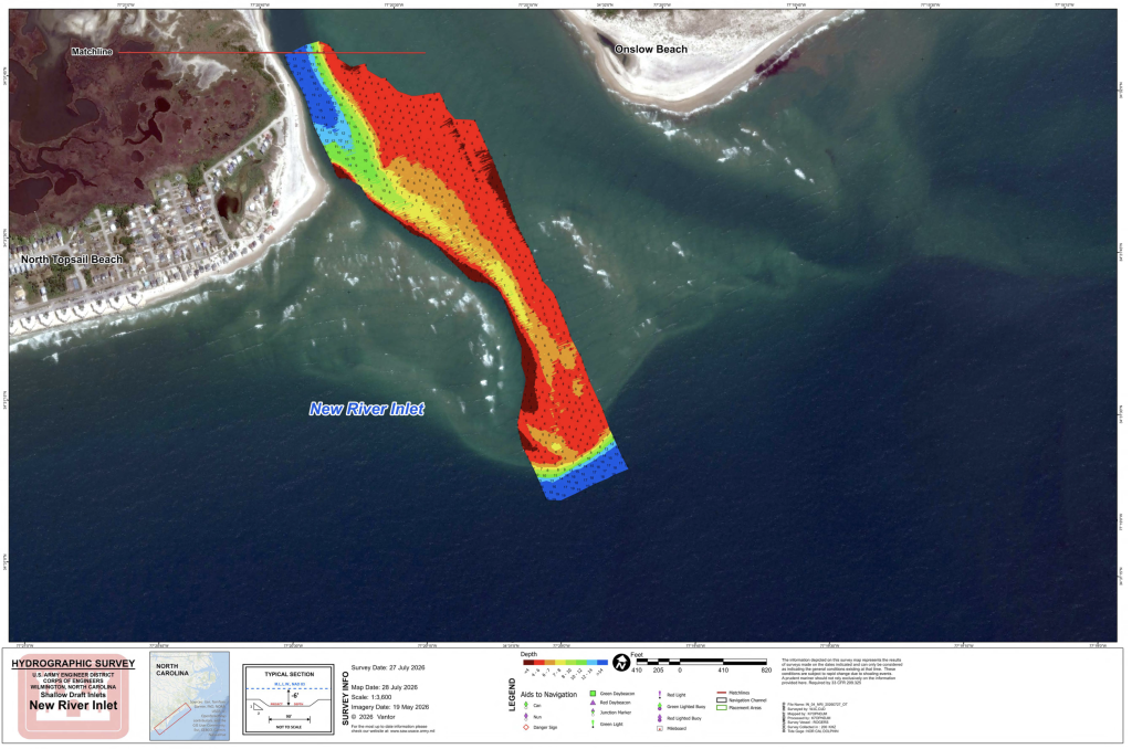
Date: JULY 27, 2026
Source: U.S. Army Corps of Engineers
Public domain material. Provided for reference only. Conditions change rapidly.
Download PDF: New River Inlet July 27 2026
New Topsail Inlet
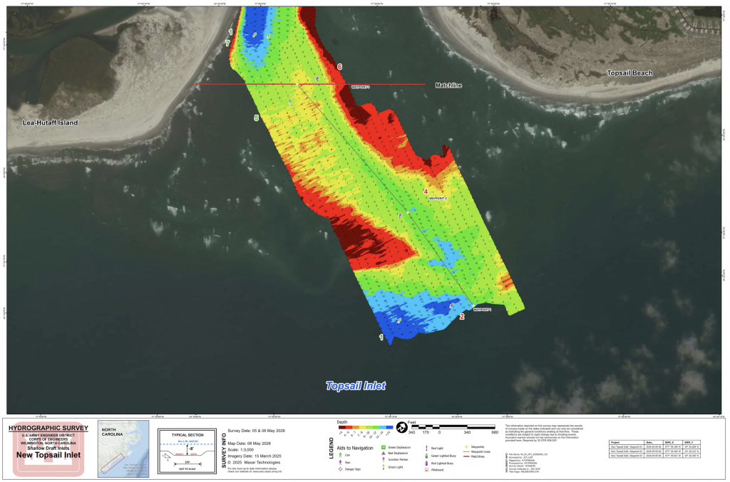
Date: May 5th 2026
Source: U.S. Army Corps of Engineers
Public domain material. Provided for reference only. Conditions change rapidly.
Download PDF: Topsail Inlet, May 5th
Masonboro Inlet
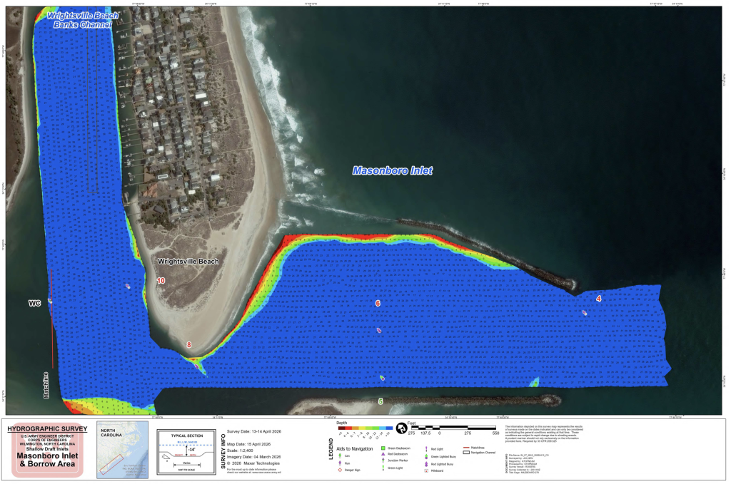
Date: April 13-14 2026
Source: U.S. Army Corps of Engineers
Public domain material. Provided for reference only. Conditions change rapidly.
Download PDF: Masonboro Inlet & Borrow Area, April 13-14, 2026
Carolina Beach Inlet
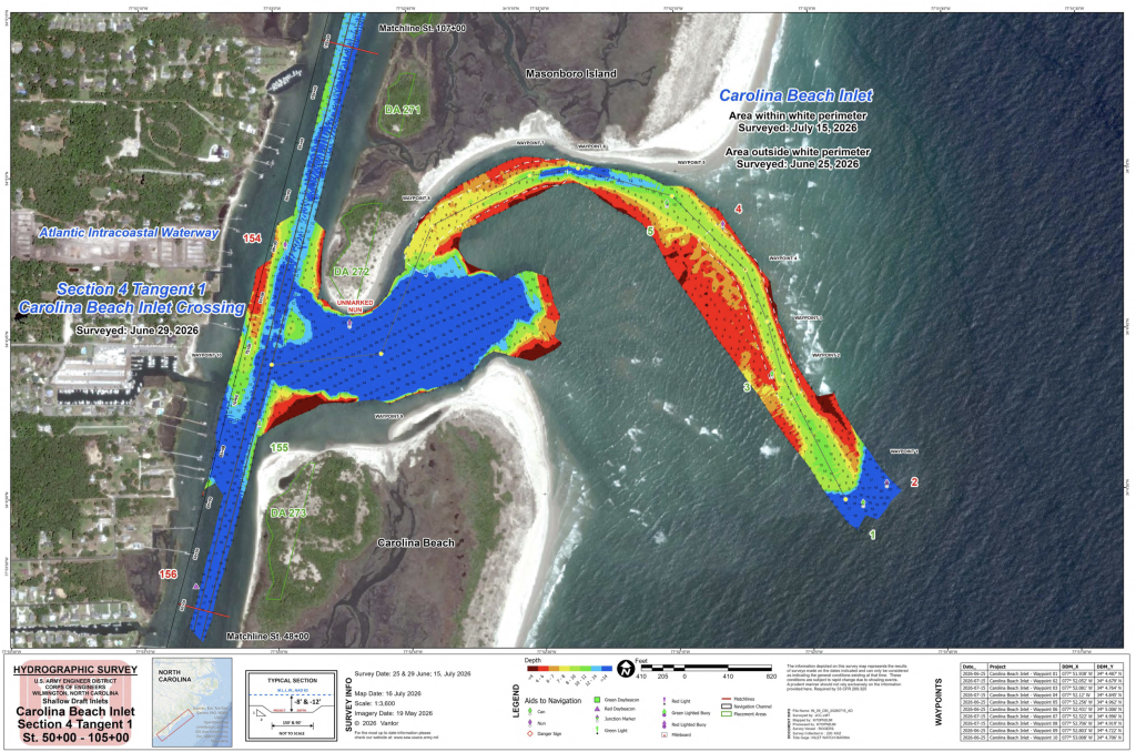
Date: June 25 & 29 2026
Source: U.S. Army Corps of Engineers
Public domain material. Provided for reference only. Conditions change rapidly.
Download PDF: Carolina Beach Inlet & AIWW Section 4 Tangent 1, June 25 & 29 2026